West Newbury Fire Department Responds to Basement Fire
WEST NEWBURY — Chief Michael Dwyer reports that the West Newbury Fire Department responded to a two alarm basement fire at a single family home on Monday night.
WEST NEWBURY — Chief Michael Dwyer reports that the West Newbury Fire Department responded to a two alarm basement fire at a single family home on Monday night.
GROVELAND — Chief Jeffrey Gillen reports that the Groveland Police Department arrested a man early this morning on two charges following a traffic stop.
JUSTIN FARINATO, AGE 37, OF GROVELAND was arrested and charged with Operating a Motor Vehicle With a Revoked License (Second Offense) and Providing a False Name to a Police Officer.
Early this morning, Groveland Police investigators determined that FARINATO, who is known to police, was operating a rental car despite his license being revoked and that he allegedly provided a false name when questioned by law enforcement.
At 6:39 a.m., an officer monitoring traffic on Seven Star Road observed the gray Hyundai sedan, known to have been rented by FARINATO. Officers began to follow the vehicle and subsequently stopped it on Main Street. During their interaction, FARINATO allegedly informed officers he did not have his license and subsequently provided officers with a family member’s name as his own.
Officers confirmed his true identity and subsequently took FARINATO into custody without incident. He was scheduled to be arraigned in Haverhill District Court this morning.
This case is part of an open investigation.
These are allegations. All suspects are innocent until proven guilty.
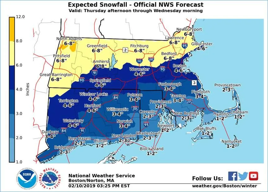
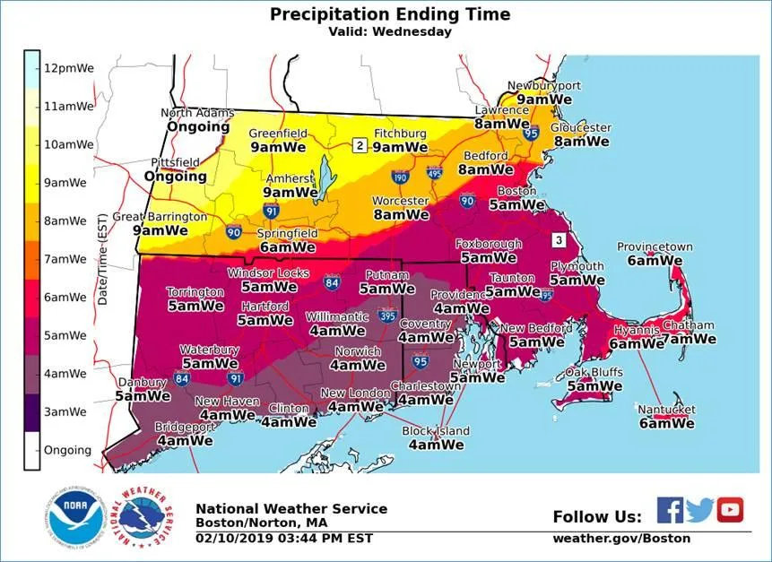
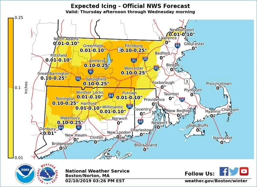
The National Weather Service (NWS) is forecasting precipitation to move into the state midday Tuesday, with initial snows transitioning to a wintry mix of mostly sleet with some freezing rain across the interior, and to rain along the coast, ending my mid-morning Wednesday. This storm will impact the Tuesday evening commute.
NWS has issued a Winter Storm Watch for Berkshire, Hampden, Hampshire, Franklin, Worcester, Middlesex, Essex, Suffolk and Norfolk counties.
Please see the forecast information and graphics below from the National Weather Service for likely timing of precipitation (onset and ending), snowfall amounts, and icing amounts.
From the National Weather Service:
What / Where / When …
o Hazardous travel conditions on roads, especially untreated surfaces, and reductions in visibility as a result of potential high snowfall rates.
Uncertainty …
Graphics: